
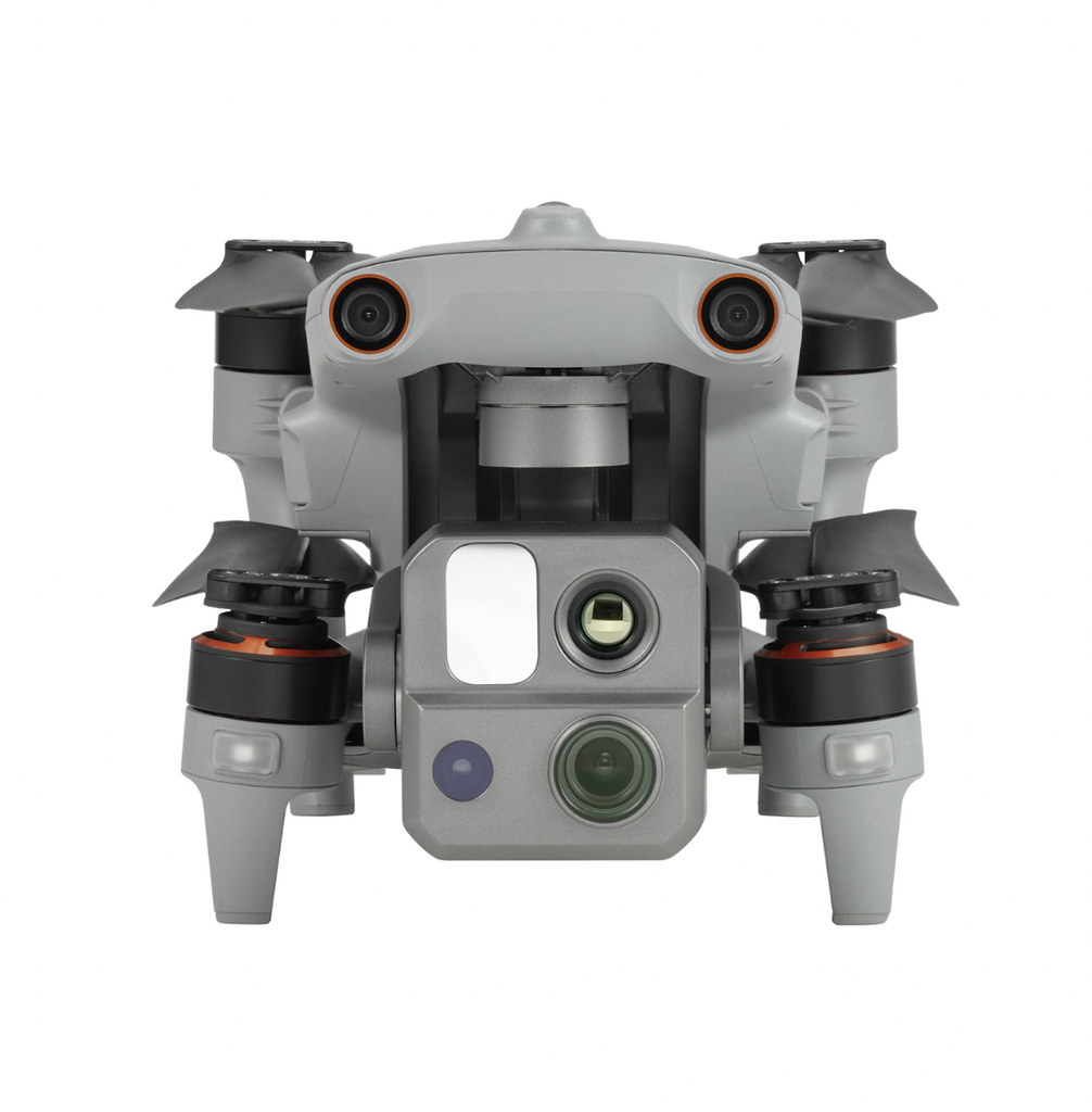
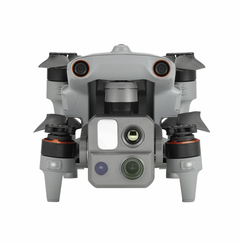

Powerful, multifunctional payload system
The EVO Max 4T is equipped with a detachable payload perfect for multiple use cases. Two screws remove the payload, making for quick repairs, swaps, or upgrades. But the best about it are the following components:
-
Zoom camera
This camera supports 8K 10x optical zoom and 160x max hybrid zoom with clear details on targets up to 1.24 miles away.
-
Thermal camera
This 640x512 high-resolution thermal imaging camera supports 30fps videos and 16x digital zoom.
-
Wide camera
This camera can capture 4K 30fps videos with max ISO of 64000. The Moonlight Algorithm 2.0 boosts post-processing and allows you to capture crisp, detailed images in low-light environments. Expect reduced noise and enhanced HDR in photos.
-
Laser rangefinder
This allows you to get the coordinates and altitude of a target from up to 0.75 miles away just with a tap on the RC screen.
Find paths effortlessly.
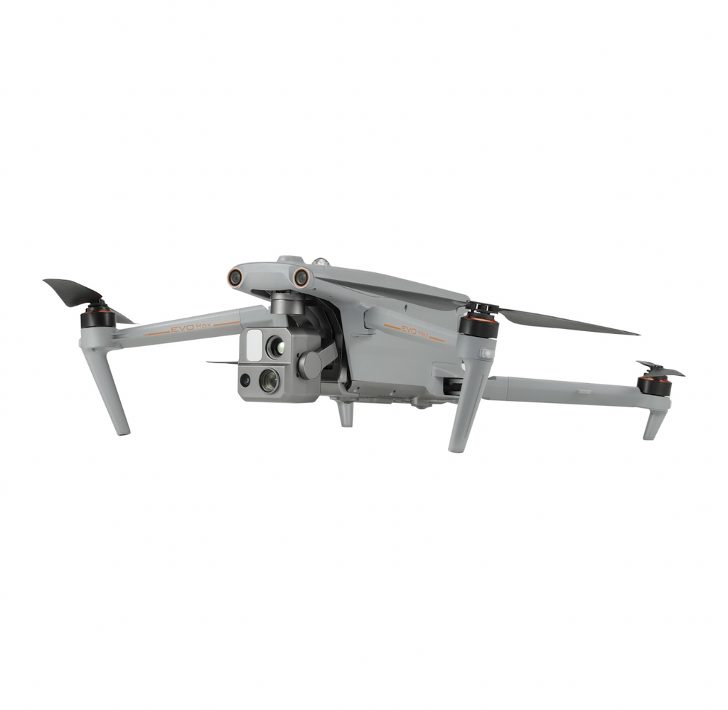
The Autonomy Engine from Autel gathers environmental data from the immediate area and designs 3D flying pathways through challenging terrain including mountains, woods, and structures. Rapid 3D scene reconstruction, public safety surveillance, industrial inspection, and land surveying are examples of use cases.
No GPS? No problem.
The EVO Max 4T can navigate in areas without GPS, underground, or inside of fortified structures thanks to its advanced sensors.
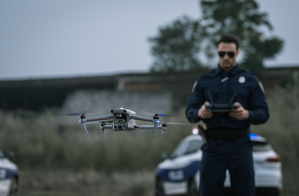
Identify and track objects accurately.
The EVO Max 4T can achieve high-altitude tracking and data collecting for law enforcement thanks to Autel's AI recognition technology, which enables it to instantly recognize and latch onto a variety of objects like heat sources, moving persons, or moving vehicles.
Zero blind spots, anti-interference
The Autel EVO Max 4T is the only commercial drone that combines millimeter wave radar technology with conventional binocular vision systems. The built-in Autel Autonomy Engine perceives objects down to 0.5 inches, removing blind spots and letting you operate the drone even in low-light environments.
To counter RFI, EMI, and GPS spoofing, the aircraft combines cutting-edge flight control modules and algorithms. Now you can fly safely close to power lines, critical structures, and challenging terrain.
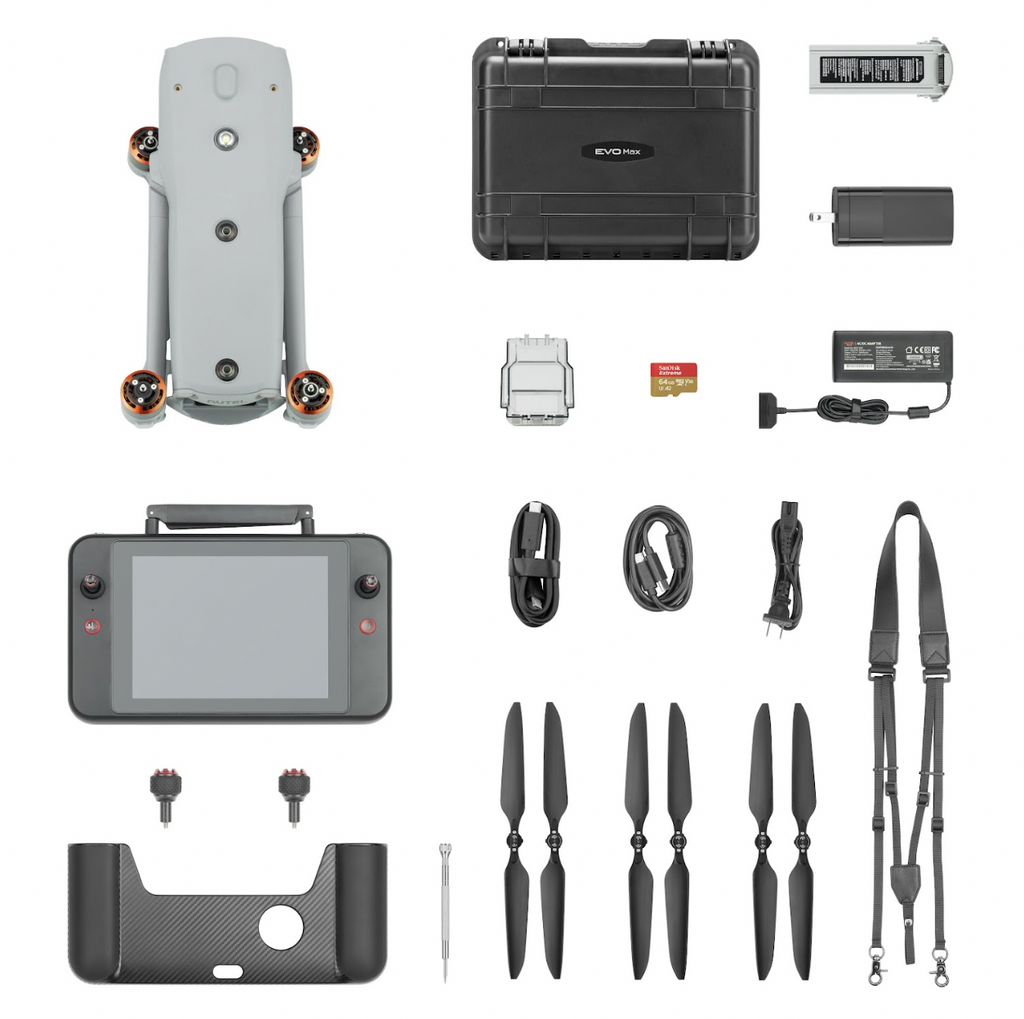
Set up your EVO Max 4T drone fleet
Autel brings you the drone industry’s first mesh networking technology—A-Mesh 1.0. This innovative mesh system, incorporated into the EVO Max 4T, enables drone-to-drone autonomous communication, connection, and cooperation.
In contrast to a conventional chain structure, the EVO Max 4T can effortlessly connect with nearby drones. The entire system will automatically self-organize and continue to communicate vital information if a single drone malfunctions or abruptly departs.
With or without LTE service, a single pilot or a group of pilots can simultaneously manage many drones on their own.
Data security a priority
Autel values your drone data privacy and security. With EVO Max 4T, user and aircraft data, including flight logs, locations, and account information can only be physically accessed via the aircraft locally.
The drone supports AES-256 encryption for photos, videos, and flight logs. All of these can be password-protected.
Made for multiple industries and use cases
The Autel EVO Max 4 is designed to be used by multiple industries for various use cases.
-
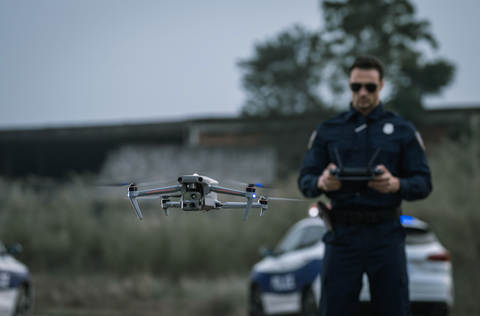
Law enforcement
- Subject monitoring & tracking
- General reconnaissance & intel gathering
- Disaster response
- Scene photography and reconstruction
- Pre-planning & situational response
-
Fire and rescue
- Identify fire lines
- Maintain fire breaks
- Inspection of structures & hot spots
- Visual access to areas with difficult terrain
- Identify impassable areas for support aircraft
-
Utilities and infrastructure
- Simplified tower inspection
- Power & pipeline inspection
- Wind turbine inspection
- Grid mapping & surveying
- Site patrol & security
-
Construction
- Site planning & evaluation
- Monitoring & tracking
- Progress reports, validation, & proof of execution
- Site patrol & security
-
Mining and mapping
- Planning & progress monitoring
- Volumetrics
- Change detection
- Remediation
- Safety, security, and surveillance
-
Content and media
- Real-time coverage of events
- Incident reconstruction & storytelling
- Photos & videos in hard to reach locations
- Content creation & cinematography
- Frequent updates & reports on key topics
